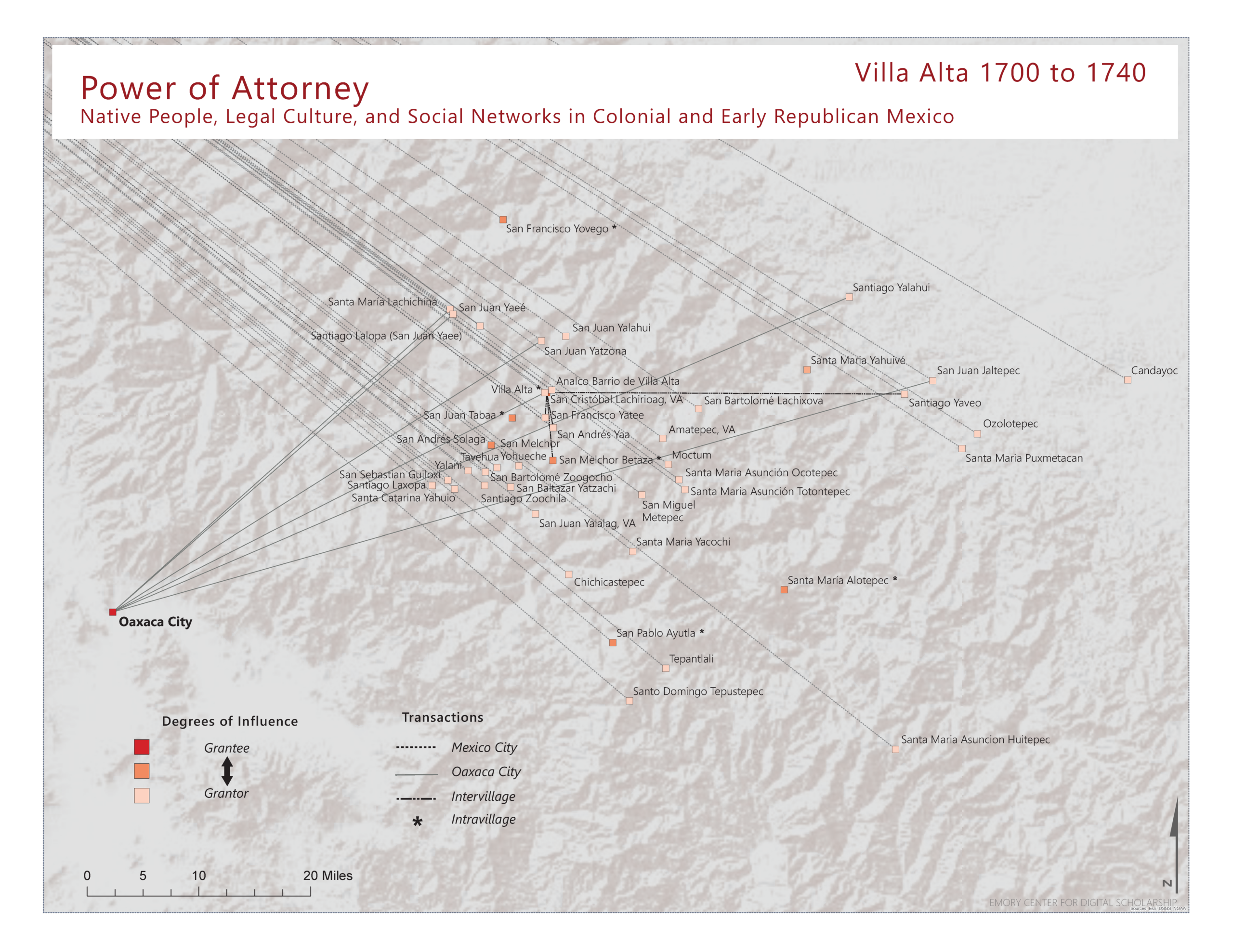
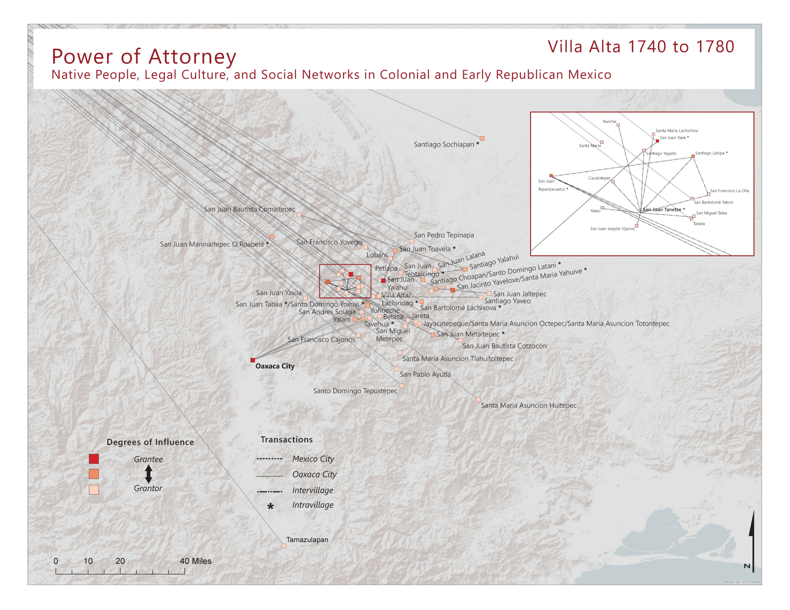
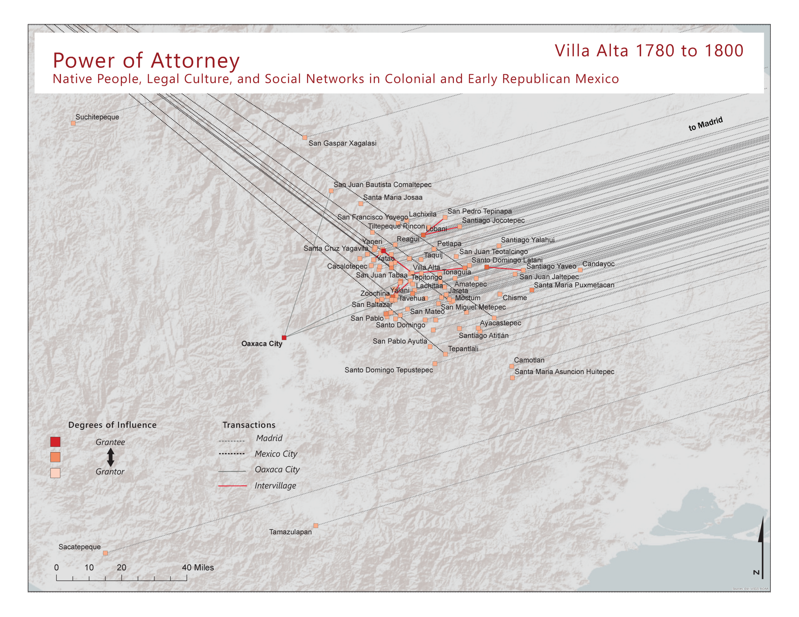
I am currently working with Emory University’s Digital Humanities Center to produce the first series of maps in this project: “Power of Attorney, Villa Alta, 1700-1821.” The first step in the process was to compile and organized the letters of attorney, cull relevant information, experiment with data categories, and enter and standardize the data in Excel. Next, we needed to transform the EXCEL data into a relational database, which included unique identifiers for people, places, and each letter of attorney, as well as coordinates for all of the relevant communities.
Exploring Indigenous Regions and Colonial Parish Seats